Géolocaliser

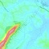
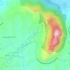
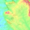
Carte topographique Kuruva Island

Cliquez sur la carte pour afficher l’altitude.

À propos de cette carte

Nom : Carte topographique Kuruva Island, altitude, relief.

Lieu : Kuruva Island, Sulthanbathery, Wayanad District, Kerala, India (11.80550 76.08514 11.83762 76.09906)

Altitude moyenne : 733 m

Altitude minimum : 704 m

Altitude maximum : 817 m

Autres cartes topographiques

Cliquez sur une carte pour visualiser sa topographie, son altitude et son relief.
Sultan Bathery

India > Kerala > Sulthanbathery

Sulthan Bathery is located at 11°40′N 76°17′E / 11.67°N 76.28°E / 11.67; 76.28. It has an average elevation of 907 m (2,976 ft).

Altitude moyenne : 876 m
Kenichira

India > Kerala > Sulthanbathery

Altitude moyenne : 788 m

Muthanga

India > Kerala > Sulthanbathery

Altitude moyenne : 866 m

Koliyadi

India > Kerala > Sulthanbathery

Altitude moyenne : 886 m

Sulthan Bathery

India > Kerala > Sulthanbathery > Sultan Bathery

Altitude moyenne : 873 m

Marakavu

India > Kerala > Sulthanbathery > Pulpally

Altitude moyenne : 769 m

Kenichira

India > Kerala > Sulthanbathery

Altitude moyenne : 770 m

Nellarachal

India > Kerala > Sulthanbathery

Altitude moyenne : 781 m

Vadakkanad

India > Kerala > Sulthanbathery

Altitude moyenne : 896 m

Edakkal

India > Kerala > Sulthanbathery > Ambalavayal

Altitude moyenne : 927 m

Kalluvayal

India > Kerala > Sulthanbathery > Pulpally

Altitude moyenne : 816 m

Nadavayal

India > Kerala > Sulthanbathery

Altitude moyenne : 751 m

Seethamount

India > Kerala > Sulthanbathery > Kabanigiri

Altitude moyenne : 731 m

Ambalavayal

India > Kerala > Sulthanbathery

Altitude moyenne : 880 m

Meenangadi

India > Kerala > Sulthanbathery

Altitude moyenne : 760 m

Kolagappara

India > Kerala > Sulthanbathery

Altitude moyenne : 795 m

Pazhoor

India > Kerala > Sulthanbathery

Altitude moyenne : 881 m

Kalluvayal

India > Kerala > Sulthanbathery > Pulpally

Altitude moyenne : 816 m

Poothadi

India > Kerala > Sulthanbathery

Altitude moyenne : 742 m

Pulpally

India > Kerala > Sulthanbathery

Altitude moyenne : 781 m

Sultan Bathery

India > Kerala > Sulthanbathery

Sulthan Bathery is located at 11°40′N 76°17′E / 11.67°N 76.28°E / 11.67; 76.28. It has an average elevation of 907 m (2,976 ft).

Altitude moyenne : 876 m
Ambalavayal

India > Kerala > Sulthanbathery

Altitude moyenne : 880 m

Meenangadi

India > Kerala > Sulthanbathery

Altitude moyenne : 760 m

Paplassery

India > Kerala > Sulthanbathery

Altitude moyenne : 795 m

Sultan Bathery

India > Kerala > Sulthanbathery

Sultan Bathery is located at 11°40′N 76°17′E / 11.67°N 76.28°E / 11.67; 76.28, on the Kozhikode–Kollegal National Highway (NH 766) 97 kilometers from Kozhikode. It is 114 km from Mysore and about 100 km from Ooty (Udagamandalam). It is also connected with Nilambur. It has an average…

Altitude moyenne : 876 m

Sulthan Bathery

India > Kerala > Sulthanbathery > Sultan Bathery

Altitude moyenne : 873 m

Muthanga

India > Kerala > Sulthanbathery

Altitude moyenne : 866 m

Équipez-vous pour votre prochaine aventure :

🧂Spray anti-ours - Sécurité en zones sauvages canadiennes
🧼Savon de camping biodégradable - Respectez l'environnement lors de vos expéditions
⌚Montre avec altimètre et baromètre - Suivi de l'élévation en temps réel synchronisé avec la carte
🧤Gants thermiques outdoor - Gants pour conditions froides en extérieur
🔥Réchauds de camping - Réchauds portables pour cuisine outdoor

En tant que Partenaire Amazon, ce site perçoit une commission sur les achats éligibles sans surcoût pour vous.