Géolocaliser

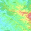
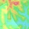
Carte topographique Pulpally

Cliquez sur la carte pour afficher l’altitude.

À propos de cette carte

Nom : Carte topographique Pulpally, altitude, relief.

Lieu : Pulpally, Sulthanbathery, Wayanad, Kerala, 673579, India (11.77327 76.14439 11.81327 76.18439)

Altitude moyenne : 781 m

Altitude minimum : 733 m

Altitude maximum : 877 m

Autres cartes topographiques

Cliquez sur une carte pour visualiser sa topographie, son altitude et son relief.
Kuruva Island

India > Kerala > Sulthanbathery

Altitude moyenne : 733 m

Kenichira

India > Kerala > Sulthanbathery

Altitude moyenne : 788 m

Sulthan Bathery

India > Kerala > Sulthanbathery > Sultan Bathery

Altitude moyenne : 873 m

Marakavu

India > Kerala > Sulthanbathery > Pulpally

Altitude moyenne : 769 m

Nellarachal

India > Kerala > Sulthanbathery

Altitude moyenne : 781 m

Vadakkanad

India > Kerala > Sulthanbathery

Altitude moyenne : 896 m

Edakkal

India > Kerala > Sulthanbathery > Ambalavayal

Altitude moyenne : 927 m

Kalluvayal

India > Kerala > Sulthanbathery > Pulpally

Altitude moyenne : 816 m

Seethamount

India > Kerala > Sulthanbathery > Kabanigiri

Altitude moyenne : 731 m

Kalluvayal

India > Kerala > Sulthanbathery > Pulpally

Altitude moyenne : 816 m

Poothadi

India > Kerala > Sulthanbathery

Altitude moyenne : 742 m

Sulthan Bathery

India > Kerala > Sulthanbathery > Sultan Bathery

Altitude moyenne : 873 m

Équipez-vous pour votre prochaine aventure :

🐻Conteneurs anti-ours - Stockage sécurisé de nourriture
🍲Repas lyophilisés pour camping - Nourriture légère et nutritive pour les longues randonnées
🔦Mini lampe LED porte-clés - Éclairage d'appoint toujours à portée de main
🎒Sacs à dos journée - Sacs compacts pour randonnées à la journée
📱Supports smartphone randonnée - Supports pratiques pour navigation mobile

En tant que Partenaire Amazon, ce site perçoit une commission sur les achats éligibles sans surcoût pour vous.