Géolocaliser

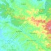
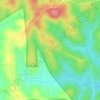
Carte topographique Kolagappara

Cliquez sur la carte pour afficher l’altitude.

À propos de cette carte

Nom : Carte topographique Kolagappara, altitude, relief.

Lieu : Kolagappara, Sulthanbathery, Wayanad, Kerala, 673591, India (11.65326 76.19446 11.65336 76.19456)

Altitude moyenne : 795 m

Altitude minimum : 750 m

Altitude maximum : 974 m

Autres cartes topographiques

Cliquez sur une carte pour visualiser sa topographie, son altitude et son relief.
Kuruva Island

India > Kerala > Sulthanbathery

Altitude moyenne : 733 m

Kenichira

India > Kerala > Sulthanbathery

Altitude moyenne : 788 m

Sulthan Bathery

India > Kerala > Sulthanbathery > Sultan Bathery

Altitude moyenne : 873 m

Marakavu

India > Kerala > Sulthanbathery > Pulpally

Altitude moyenne : 769 m

Nellarachal

India > Kerala > Sulthanbathery

Altitude moyenne : 781 m

Vadakkanad

India > Kerala > Sulthanbathery

Altitude moyenne : 896 m

Edakkal

India > Kerala > Sulthanbathery > Ambalavayal

Altitude moyenne : 927 m

Kalluvayal

India > Kerala > Sulthanbathery > Pulpally

Altitude moyenne : 816 m

Seethamount

India > Kerala > Sulthanbathery > Kabanigiri

Altitude moyenne : 731 m

Kalluvayal

India > Kerala > Sulthanbathery > Pulpally

Altitude moyenne : 816 m

Poothadi

India > Kerala > Sulthanbathery

Altitude moyenne : 742 m

Sulthan Bathery

India > Kerala > Sulthanbathery > Sultan Bathery

Altitude moyenne : 873 m

Équipez-vous pour votre prochaine aventure :

🔊Haut-parleur Bluetooth étanche - Musique pour le camp de base résistant aux intempéries
🥾Chaussures de randonnée - Chaussures robustes pour la randonnée et les terrains accidentés
🖼️Art mural topographique - Décoration élégante représentant des reliefs célèbres
🩹Trousse de premiers soins de secours - Compacte et complète pour les blessures légères en sentier
📦Rangement matériel outdoor - Organisation de l'équipement

En tant que Partenaire Amazon, ce site perçoit une commission sur les achats éligibles sans surcoût pour vous.