Géolocaliser

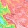
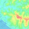
Carte topographique Peerumade

Cliquez sur la carte pour afficher l’altitude.

À propos de cette carte

Nom : Carte topographique Peerumade, altitude, relief.

Lieu : Peerumade, Idukki, Kerala, India (9.27254 76.86662 9.77354 77.41236)

Altitude moyenne : 792 m

Altitude minimum : 28 m

Altitude maximum : 1 962 m

Autres cartes topographiques

Cliquez sur une carte pour visualiser sa topographie, son altitude et son relief.
Vellarada

India > Kerala > Neyyattinkara

Vellarada is also known for its hilltop shrine "Kurisumala Pilgrim Centre" (also called Thekkan kurisumala) at an elevation of 640 metres (2,100 ft). Thousands of devotees from various parts of Tamil Nadu, Kerala, Andhra Pradesh and Karnataka visit the shrine during Lent every year.

Altitude moyenne : 124 m
Adoor

India > Kerala > Adoor

Altitude moyenne : 43 m

Kulathupuzha

India > Kerala

Altitude moyenne : 226 m

Thiruvananthapuram

India > Kerala > Thiruvananthapuram

Thiruvananthapuram is built on seven hills by the seashore and is at 8°30′N 76°54′E / 8.5°N 76.9°E / 8.5; 76.9 on the west coast, near the southern tip of mainland India. The city is on the west coast of India and is bounded by the Laccadive Sea to its west and the Western Ghats to its east.…

Altitude moyenne : 33 m
Western Ghats

India > Kerala > Devikulam

The range starts near south of the Tapti river and runs approximately 1,600 km (990 mi) through the states of Gujarat, Maharashtra, Karnataka, Goa, Kerala and Tamil Nadu ending at Marunthuvazh Malai, Swamithope near the southern tip of India. These hills cover 160,000 km2 (62,000 sq mi) and form the catchment…

Altitude moyenne : 2 225 m
Kochi

India > Kerala > Kochi

Altitude moyenne : 4 m

Varkala

India > Kerala > Varkala

Altitude moyenne : 24 m

Willingdon Island

India > Kerala > Kochi > Kochi

Altitude moyenne : 4 m

Vagamon

India > Kerala > Peerumade

Vagamon, due to its elevation and climate, has a unique ecosystem, leading to the emergence of rich natural vegetation, plant species, shola forests etc. From the early 20th century plantation crops like tea, coffee started. Vagamon hills are home to less explored flora and fauna. A faunal diversity study…

Altitude moyenne : 866 m
Ernakulam

India > Kerala > Kanayannur

The Ernakulam District is situated in Central Kerala in India. Ernakulam is located at 9°59′N 76°17′E / 9.98°N 76.28°E / 9.98; 76.28. It has an average elevation of 4 m (13 ft).

Altitude moyenne : 6 m

Muniyara

India > Kerala > Idukki > Panickankudy

Altitude moyenne : 785 m

Thiruvananthapuram

India > Kerala > Thiruvananthapuram

Thiruvananthapuram is built on seven hills by the seashore and is at 8°30′N 76°54′E / 8.5°N 76.9°E / 8.5; 76.9 on the west coast, near the southern tip of mainland India. The city is on the west coast of India and is bounded by the Laccadive Sea to its west and the Western Ghats to its east.…

Altitude moyenne : 33 m

Chaliyar River

India > Kerala

Altitude moyenne : 60 m

Chunkappara

India > Kerala > Mallappally

Altitude moyenne : 78 m

Perumbalam

India > Kerala > Cherthala > Perumbalam

Altitude moyenne : 3 m

Meenangadi

India > Kerala > Sulthanbathery

Altitude moyenne : 760 m

Karalmanna

India > Kerala > Ottappalam

Altitude moyenne : 55 m

Thampuran para

India > Kerala > Nedumangad

Altitude moyenne : 130 m

Pathanamthitta

India > Kerala

Pathanamthitta has an average elevation of 18 metres (62 ft) above sea level.

Altitude moyenne : 63 m

Mananthavady

India > Kerala

Altitude moyenne : 751 m

Periyar River

India > Kerala > Kochi

Altitude moyenne : 7 m

Meenachil River

India > Kerala

Altitude moyenne : 31 m

Konnakad

India > Kerala

Altitude moyenne : 442 m

Idamalayar

India > Kerala

Altitude moyenne : 838 m

Idamalayar Dam

India > Kerala

The Idamalayar Dam is located on the Idamalayar River, a tributary of the Periyar River in Kerala. Edamalayar originates in the Anamala Hills at elevation of 2,520 metres (8,270 ft). The river is a perennial source draining a catchment area of 381 km2 (147 sq mi) with a topography of high relief. The catchment…

Altitude moyenne : 257 m

Meppadi

India > Kerala

Altitude moyenne : 857 m

Kaliyar

India > Kerala > Kaliyar

Altitude moyenne : 46 m

Chinnar

India > Kerala

Altitude moyenne : 670 m

Vazhathope

India > Kerala

Altitude moyenne : 694 m

Thonikkadavu

India > Kerala

Altitude moyenne : 109 m

Thariode

India > Kerala

Altitude moyenne : 761 m

Melmury

India > Kerala

Altitude moyenne : 925 m

Mundakai

India > Kerala

Altitude moyenne : 1 020 m

Chooralmala

India > Kerala

Altitude moyenne : 854 m

Vaduvanchal

India > Kerala

Altitude moyenne : 858 m

Nilambur

India > Kerala > Nilambur

The 2,554 m (8,379 ft) m high Mukurthi peak, which is situated in the border of Nilambur Taluk and Ooty Taluk, and is also the fifth-highest peak in South India as well as the third-highest in Kerala after Anamudi (2,696 m [8,845 ft]) and Meesapulimala (2,651 m [8,698 ft]), is the highest point of elevation in…

Altitude moyenne : 33 m

Kottathara

India > Kerala

Altitude moyenne : 738 m

Kozhikode

India > Kerala > Kozhikode

Altitude moyenne : 14 m

Kalamassery

India > Kerala > Kanayannur

Altitude moyenne : 10 m

Vaikom

India > Kerala > Vaikom

Altitude moyenne : 4 m

Vithura

India > Kerala > Nedumangad

Altitude moyenne : 132 m

Mannur

India > Kerala > Palakkad > Mannur

Altitude moyenne : 66 m

Muttom

India > Kerala > Muttom > Idukki

Altitude moyenne : 157 m

Kanjar

India > Kerala > Kanjar > Idukki

Altitude moyenne : 282 m

Muvattupuzha

India > Kerala > Muvattupuzha

The town and western parts of the region are mainly plains and is culturally similar to Ernakulam, whereas the eastern parts are mainly highlands. The regions of Thodupuzha, Muvattupuzha, and Kothamangalam are called sub-high ranges or keezhmalanad of Vadakkumkoor Kingdom, indicating they were lands with…

Altitude moyenne : 28 m

Achenkovil

India > Kerala > Kozhenchery

Altitude moyenne : 34 m

Alakode

India > Kerala > Taliparamba

Altitude moyenne : 167 m

Melattur

India > Kerala > Perinthalmanna > Melattur

Altitude moyenne : 55 m

Kizhakkekallada

India > Kerala > Kollam

Altitude moyenne : 10 m

Kakkanadu-Thenamara

India > Kerala > Cherthala

Altitude moyenne : 9 m

Calvary Mount

India > Kerala > Idukki

Altitude moyenne : 944 m

Poomala Dam

India > Kerala > Thrissur > Thrissur

Altitude moyenne : 99 m

Murukkumpuzha

India > Kerala > Thiruvananthapuram

Altitude moyenne : 17 m

Bharathapuzha

India > Kerala > Palakkad > Palakkad

Altitude moyenne : 88 m

Chembra peak

India > Kerala > Thamarassery > Vythiri

Altitude moyenne : 1 628 m

East Mattukkatta

India > Kerala > Idukki > Vellilamkandam

Altitude moyenne : 831 m

Pozhiyoor

India > Kerala > Neyyattinkara

Altitude moyenne : 15 m

Enaathu

India > Kerala > Adoor

Altitude moyenne : 30 m

Valanjavazhi

India > Kerala > Ambalappuzha > Ambalappuzha

Altitude moyenne : 4 m

Mundakkayam

India > Kerala > Kanjirappally

Altitude moyenne : 145 m

Perinthalmanna

India > Kerala > Perinthalmanna

Altitude moyenne : 76 m

Neriamangalam-Painavu Road Road

India > Kerala > Idukki

Altitude moyenne : 497 m

Neyyar

India > Kerala > Kattakkada > Keezharoor

Altitude moyenne : 57 m

Karipputhattu

India > Kerala > Kottayam > Pulikuttisseri

Altitude moyenne : 6 m

Choozhattukotta

India > Kerala > Kattakkada

Altitude moyenne : 37 m

Aralam

India > Kerala > Iritty

Altitude moyenne : 67 m

Pavaratty

India > Kerala > Chavakkad

Altitude moyenne : 7 m

Pallikunnu

India > Kerala > Kannur

Altitude moyenne : 14 m

Pallippuram

India > Kerala > Cherthala

Altitude moyenne : 5 m

Vazhichal

India > Kerala > Kattakkada

Altitude moyenne : 132 m

Muliyar

India > Kerala > Kasaragod

Altitude moyenne : 93 m

Pothanicad

India > Kerala > Kothamangalam

Altitude moyenne : 33 m

Mattul

India > Kerala > Kannur

Altitude moyenne : 3 m

Mundakottukurushi

India > Kerala > Ottappalam

Altitude moyenne : 68 m

Kizhakkumbhagom kulam

India > Kerala > Kottarakkara > Chithara

Altitude moyenne : 163 m

Paingottoor

India > Kerala > Kothamangalam

Altitude moyenne : 39 m

Pooyamkutty

India > Kerala > Kothamangalam

Altitude moyenne : 129 m

Pala

India > Kerala > Pala

Altitude moyenne : 28 m

Kakkanad

India > Kerala > Kanayannur > Kakkanad

Altitude moyenne : 13 m

Kannur

India > Kerala > Kannur

Kannur has an elevation of 1.02 metres or 3.3 feet along the coast of the Laccadive Sea, with a sandy coastal area. The city has an 8 kilometres (5.0 mi)-long seashore and a 3 kilometres (1.9 mi)-long beach at Payyambalam. Kannur is located north of Kozhikode, south of Kasargod and Mangalore, west of the…

Altitude moyenne : 13 m
Kollam

India > Kerala > Kollam

Cosmas Indicopleustes, a Greek Nestorian sailor, in his book the Christian Topography who visited the Malabar Coast in 550, mentions an enclave of Christian believers in Male (Malabar Coast). He writes, "In the island of Tabropane (Ceylon), there is a church of Christians, and clerics and faithful. Likewise at…

Altitude moyenne : 11 m
Palakkad

India > Kerala > Palakkad

Altitude moyenne : 205 m

Thrissur

India > Kerala > Thrissur

Thrissur is the headquarters of Thrissur district, in the centre of the Indian state of Kerala. The city is 75 km north-east of Kochi, 133 km south-west of Coimbatore, 124 km south-east of Kozhikode and 151 km north of Changanacherry. The city is located in a hillock called Thekkinkadu Maidan which is the…

Altitude moyenne : 36 m
Changanassery

India > Kerala > Changanassery

Altitude moyenne : 8 m

Munnar

India > Kerala > Devikulam

Altitude moyenne : 1 603 m

Kadavoor

India > Kerala > Kothamangalam

Altitude moyenne : 53 m

Ongallur

India > Kerala > Pattambi

Altitude moyenne : 41 m

Thiruvaniyoor

India > Kerala > Kunnathunad

Altitude moyenne : 27 m

Kalady

India > Kerala > Aluva

Altitude moyenne : 14 m

Arimbur

India > Kerala > Thrissur

Altitude moyenne : 3 m

Kuruva Island

India > Kerala > Sulthanbathery

Altitude moyenne : 733 m

Angadimogar

India > Kerala > Manjeswaram

Altitude moyenne : 39 m

Uchakkada

India > Kerala > Neyyattinkara

Altitude moyenne : 23 m

Kottathara

India > Kerala > Mannarkad

Altitude moyenne : 549 m

Pottammal

India > Kerala > Kozhikode > Thondayad

Altitude moyenne : 20 m

Sarovaram Bio Park

India > Kerala > Kozhikode > Erenjippalam

Altitude moyenne : 14 m

Champakulam

India > Kerala > Kuttanad

Altitude moyenne : 3 m

Équipez-vous pour votre prochaine aventure :

🧴Écran solaire sport SPF 50 - Protection contre les rayons UV intenses en montagne
🩹Trousse de premiers soins de secours - Compacte et complète pour les blessures légères en sentier
🍳Ensemble de cuisine de camping - Casseroles et poêles compactes pour le bivouac
🩹Kit de réparation de tente - Patchs adhésifs pour trous et déchirures sur le terrain
🪜Bâtons de marche - Soutien pour longues distances

En tant que Partenaire Amazon, ce site perçoit une commission sur les achats éligibles sans surcoût pour vous.