Géolocaliser

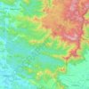
Cartes topographiques Konni

Cliquez sur une carte pour visualiser sa topographie, son altitude et son relief.

Kaipattoor

India > Kerala > Konni

Altitude moyenne : 27 m

Konnappara

India > Kerala > Konni

Altitude moyenne : 107 m

Nilakkal

India > Kerala > Konni

Altitude moyenne : 338 m

Moonnukallu

India > Kerala > Konni > Seethathodu

Altitude moyenne : 184 m

Thannithodu

India > Kerala > Konni

Altitude moyenne : 188 m

Vakayar

India > Kerala > Konni

Altitude moyenne : 75 m

Pramadom

India > Kerala > Konni

Altitude moyenne : 34 m

Nilackal

India > Kerala > Konni

Altitude moyenne : 355 m

Aruvappulam

India > Kerala > Konni

Altitude moyenne : 519 m

Gurunathanmannu

India > Kerala > Konni

Altitude moyenne : 724 m

Ponnambalamedu

India > Kerala > Konni

Ponnambalamedu is located at a distance of 4 kilometres (2.5 mi) from the Sabarimala Ayyappan temple. The summit of the hill is at an altitude of 1,170 metres (3,840 ft) from mean sea level. The hill is in the Goodrickal range of the Ranni Forest Division and has been included as a part of the Periyar National…

Altitude moyenne : 890 m

Kattathippara

India > Kerala > Konni

Altitude moyenne : 138 m

Pulippara

India > Kerala > Konni > Mallassery

Altitude moyenne : 40 m

Metta

India > Kerala > Konni

Altitude moyenne : 862 m

Sabarimala

India > Kerala > Konni

Altitude moyenne : 477 m

Konni

India > Kerala > Konni

Altitude moyenne : 78 m

À propos de ce lieu

 •

Équipez-vous pour votre prochaine aventure :

🧢Chapeau de soleil à large bord - Protection complète du visage et de la nuque
🧳Sacs étanches - Protection du matériel contre l'eau
🎒Housse de pluie pour sac à dos - Protection supplémentaire pour garder votre contenu au sec
⛺Tente de camping légère - Conçue pour le transport facile en montagne
📍GPS de randonnée - GPS portables pour suivre itinéraires et altitudes

En tant que Partenaire Amazon, ce site perçoit une commission sur les achats éligibles sans surcoût pour vous.