Carte topographique Kollam
Cliquez sur la carte pour afficher l’altitude.
Kollam
Cosmas Indicopleustes, a Greek Nestorian sailor, in his book the Christian Topography who visited the Malabar Coast in 550, mentions an enclave of Christian believers in Male (Malabar Coast). He writes, "In the island of Tabropane (Ceylon), there is a church of Christians, and clerics and faithful. Likewise at Male, where the pepper grows, and in the farming community of Kalliana (Kalliankal at Nillackal) there is also a bishop consecrated in Persia in accordance with the Nicea Sunnahadose of 325 AD." The Nestorian Patriarch Jesujabus, who died in 660 AD, mentions Kollam in his letter to Simon, Metropolitan of Persia.
À propos de cette carte
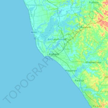
Nom : Carte topographique Kollam, altitude, relief.
Lieu : Kollam, Kerala, 691001, India (8.72705 76.43067 9.04705 76.75067)
Altitude moyenne : 11 m
Altitude minimum : -2 m
Altitude maximum : 115 m
Autres cartes topographiques
Cliquez sur une carte pour visualiser sa topographie, son altitude et son relief.
Ashtamudi Lake
India > Kerala > Kollam > Kottayathukadavu
Ashtamudi Lake (Ashtamudi Kayal), in the Kollam District of the Indian state of Kerala, is the most visited backwater and lake in the state. It possesses a unique wetland ecosystem and a large palm-shaped (also described as octopus-shaped) water body, second only in size to the Vembanad estuary ecosystem of…
Altitude moyenne : 6 m