Géolocaliser

Carte topographique Manganam

Cliquez sur la carte pour afficher l’altitude.

À propos de cette carte

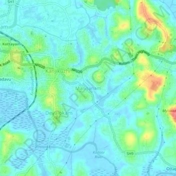
Nom : Carte topographique Manganam, altitude, relief.

Lieu : Manganam, Kottayam, Kerala, 686018, India (9.56334 76.52999 9.60334 76.56999)

Altitude moyenne : 16 m

Altitude minimum : -5 m

Altitude maximum : 73 m

Autres cartes topographiques

Cliquez sur une carte pour visualiser sa topographie, son altitude et son relief.

Sankranthi

India > Kerala > Kottayam > Kottayam

Altitude moyenne : 15 m

Meenadom

India > Kerala > Kottayam > Pariyaram

Altitude moyenne : 36 m

Manimala River

India > Kerala > Kottayam > Eravinalloor

Altitude moyenne : 12 m

Kanjikuzhy

India > Kerala > Kottayam > Manganam

Altitude moyenne : 14 m

Meenachil

India > Kerala > Kottayam > Pulikuttisseri

Altitude moyenne : 7 m

Karapuzha

India > Kerala > Kottayam > Kottayam

Altitude moyenne : 7 m

Alapuzha

India > Kerala > Kottayam > Kottayam

Altitude moyenne : 10 m

child

India > Kerala > Kottayam > Thiruvanchoor

Altitude moyenne : 13 m

Alapuzha

India > Kerala > Kottayam > Kottayam

Altitude moyenne : 10 m

Alapuzha

India > Kerala > Kottayam > Kottayam

Altitude moyenne : 10 m

Équipez-vous pour votre prochaine aventure :

🗺️Cartes topographiques - Cartes détaillées pour explorer reliefs et régions
🥾Bottes d'hiver outdoor - Chaussures pour conditions hivernales
🏕️Sacs de bivouac - Abri minimaliste pour la nuit
🍼Bouteille d'eau isotherme 1L - Maintient l'eau fraîche ou le thé chaud pendant des heures
🎒Sacs à dos journée - Sacs compacts pour randonnées à la journée

En tant que Partenaire Amazon, ce site perçoit une commission sur les achats éligibles sans surcoût pour vous.