
Carte topographique Soldeu
Carte interactive
Cliquez sur la carte pour afficher l’altitude.
À propos de cette carte
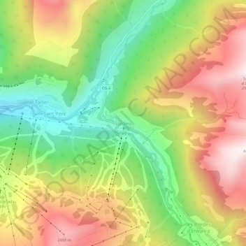
Nom : Carte topographique Soldeu, altitude, relief.
Lieu : Soldeu, Canillo, AD100, Andorra (42.55689 1.64827 42.59689 1.68827)
Altitude moyenne : 2 091 m
Altitude minimum : 1 651 m
Altitude maximum : 2 571 m
The village is at an elevation of 1,710 metres (5,610 ft) above sea level and the top of the ski area is at 2,580 m (8,465 ft). The gondola from the village rises to 2,250 m (7,380 ft), where the ski and board schools as well as restaurants are located. From there, it is possible to ski to the top of the El Tarter gondola or the village of El Tarter itself via the blue-rated 'gall de bosc' run.
Autres cartes topographiques
Cliquez sur une carte pour visualiser sa topographie, son altitude et son relief.