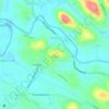
Carte topographique Gurunathanmannu
Cliquez sur la carte pour afficher l’altitude.
À propos de cette carte

Nom : Carte topographique Gurunathanmannu, altitude, relief.
Lieu : Gurunathanmannu, Konni, Pathanamthitta, Kerala, India (9.24476 77.04532 9.33083 77.10681)
Altitude moyenne : 724 m
Altitude minimum : 126 m
Altitude maximum : 1 293 m
Autres cartes topographiques
Cliquez sur une carte pour visualiser sa topographie, son altitude et son relief.


Ponnambalamedu
Ponnambalamedu is located at a distance of 4 kilometres (2.5 mi) from the Sabarimala Ayyappan temple. The summit of the hill is at an altitude of 1,170 metres (3,840 ft) from mean sea level. The hill is in the Goodrickal range of the Ranni Forest Division and has been included as a part of the Periyar National…
Altitude moyenne : 890 m