
Carte topographique Sileby
Carte interactive
Cliquez sur la carte pour afficher l’altitude.
À propos de cette carte
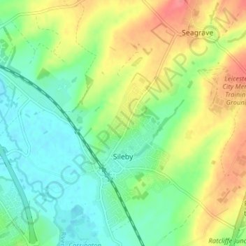
Nom : Carte topographique Sileby, altitude, relief.
Lieu : Sileby, Charnwood, Leicestershire, England, United Kingdom (52.72005 -1.13388 52.75677 -1.07061)
Altitude moyenne : 69 m
Altitude minimum : 42 m
Altitude maximum : 110 m
Autres cartes topographiques
Cliquez sur une carte pour visualiser sa topographie, son altitude et son relief.
Shepshed
United Kingdom > England > Leicestershire > Charnwood
Shepshed, Charnwood, Leicestershire, England, United Kingdom
Altitude moyenne : 111 m
Loughborough
United Kingdom > England > Leicestershire > Charnwood
Loughborough, Charnwood, Leicestershire, England, LE11 5BJ, United Kingdom
Altitude moyenne : 61 m