
Carte topographique Shepshed
Carte interactive
Cliquez sur la carte pour afficher l’altitude.
À propos de cette carte
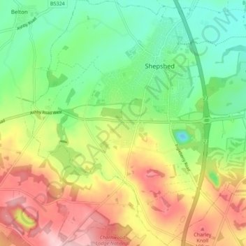
Nom : Carte topographique Shepshed, altitude, relief.
Lieu : Shepshed, Charnwood, Leicestershire, England, United Kingdom (52.73395 -1.33507 52.78541 -1.26687)
Altitude moyenne : 111 m
Altitude minimum : 35 m
Altitude maximum : 214 m
Autres cartes topographiques
Cliquez sur une carte pour visualiser sa topographie, son altitude et son relief.
Sileby
United Kingdom > England > Leicestershire > Charnwood
Sileby, Charnwood, Leicestershire, England, United Kingdom
Altitude moyenne : 69 m
Loughborough
United Kingdom > England > Leicestershire > Charnwood
Loughborough, Charnwood, Leicestershire, England, LE11 5BJ, United Kingdom
Altitude moyenne : 61 m