Géolocaliser

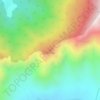
Carte topographique MANZGAM

Cliquez sur la carte pour afficher l’altitude.

À propos de cette carte

Nom : Carte topographique MANZGAM, altitude, relief.

Lieu : MANZGAM, Handwara tehsil, Kupwara District, Jammu and Kashmir, India (34.47405 74.08483 34.47983 74.09673)

Altitude moyenne : 1 888 m

Altitude minimum : 1 820 m

Altitude maximum : 2 053 m

Autres cartes topographiques

Cliquez sur une carte pour visualiser sa topographie, son altitude et son relief.

Langate

India > Jammu and Kashmir > Handwara tehsil

Altitude moyenne : 1 629 m

Handwara

India > Jammu and Kashmir > Handwara tehsil

Handwara is located at 34°24′N 74°17′E / 34.40°N 74.28°E / 34.40; 74.28 at an average elevation of 1,582 metres (5,190 feet) above sea level.

Altitude moyenne : 1 638 m
Darnar

India > Jammu and Kashmir > Handwara tehsil

Altitude moyenne : 1 981 m

Dional

India > Jammu and Kashmir > Handwara tehsil > Gung Bug

Altitude moyenne : 1 881 m

Menganwar

India > Jammu and Kashmir > Handwara tehsil

Altitude moyenne : 2 276 m

MAGAM

India > Jammu and Kashmir > Handwara tehsil

Altitude moyenne : 1 713 m

Handwara

India > Jammu and Kashmir > Handwara tehsil

Handwara is located at 34°24′N 74°17′E / 34.40°N 74.28°E / 34.40; 74.28 at an average elevation of 1,582 metres (5,190 feet) above sea level. The region boasts breathtaking natural beauty, with the Pohru River (locally called 'Talri river')—a tributary of the Jhelum—flowing through the town.

Altitude moyenne : 1 638 m

Équipez-vous pour votre prochaine aventure :

🚰Pastilles purification eau - Traitement de l'eau potable
🍳Ensemble de cuisine de camping - Casseroles et poêles compactes pour le bivouac
🧭Boussoles de navigation - Boussoles fiables pour orientation et cartographie
📱Étui de téléphone étanche - Protégez votre smartphone des chutes dans l'eau ou de la boue
❄️Crampons antidérapants - Adhérence sur neige et glace

En tant que Partenaire Amazon, ce site perçoit une commission sur les achats éligibles sans surcoût pour vous.