
Carte topographique Phong Nha Town
Carte interactive
Cliquez sur la carte pour afficher l’altitude.
À propos de cette carte
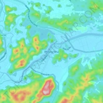
Nom : Carte topographique Phong Nha Town, altitude, relief.
Altitude moyenne : 66 m
Altitude minimum : -13 m
Altitude maximum : 400 m
Autres cartes topographiques
Cliquez sur une carte pour visualiser sa topographie, son altitude et son relief.
Sơn Lý
Vietnam > Quang Binh province > Bố Trạch District
Sơn Lý, Bố Trạch District, Quang Binh province, Vietnam
Altitude moyenne : 34 m