
Carte topographique Judith Gap
Carte interactive
Cliquez sur la carte pour afficher l’altitude.
À propos de cette carte
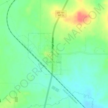
Nom : Carte topographique Judith Gap, altitude, relief.
Altitude moyenne : 1 406 m
Altitude minimum : 1 386 m
Altitude maximum : 1 442 m
Because of its topography and prevailing winds, Judith Gap is the site of one of the most ambitious wind power projects in the United States. The 90 wind turbines at the Judith Gap Wind Farm have a nameplate capacity of 135 MW.
Autres cartes topographiques
Cliquez sur une carte pour visualiser sa topographie, son altitude et son relief.
Harlowton
United States > Montana > Wheatland County
Harlowton, Wheatland County, Montana, United States
Altitude moyenne : 1 286 m