Géolocaliser

Carte topographique Kodakara

Cliquez sur la carte pour afficher l’altitude.

👉 Easily get elevation data in JSON, GeoTIFF and KML formats using Elevation API
Merci de soutenir ce site ❤️
Faire un don

À propos de cette carte

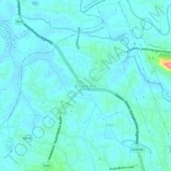
Nom : Carte topographique Kodakara, altitude, relief.

Lieu : Kodakara, Chalakkudy, Thrissur, Kerala, 680684, India (10.35171 76.28420 10.39171 76.32420)

Altitude moyenne : 12 m

Altitude minimum : -1 m

Altitude maximum : 102 m

Autres cartes topographiques

Cliquez sur une carte pour visualiser sa topographie, son altitude et son relief.

Kuzhur

India > Kerala > Chalakkudy > Valiyaparambu

Altitude moyenne : 7 m

Kakkulissery

India > Kerala > Chalakkudy > Valiyaparambu

Altitude moyenne : 10 m

Thiruthiparambu East

India > Kerala > Chalakkudy > Chalakudy

Altitude moyenne : 10 m

Athirappilly

India > Kerala > Chalakkudy

Altitude moyenne : 406 m

Kadukutty

India > Kerala > Chalakkudy > Sampaloor

Altitude moyenne : 8 m

Nandipulam

India > Kerala > Chalakkudy

Altitude moyenne : 16 m

St James Hospital

India > Kerala > Chalakkudy > Chalakudy

Altitude moyenne : 14 m

Lower Sholayar Dam

India > Kerala > Chalakkudy

Altitude moyenne : 773 m

St James Hospital

India > Kerala > Chalakkudy > Chalakudy

Altitude moyenne : 14 m

Mattathur

India > Kerala > Chalakkudy > Kodaly

Altitude moyenne : 199 m

Équipez-vous pour votre prochaine aventure :

🍳Ensemble de cuisine de camping - Casseroles et poêles compactes pour le bivouac
🔥Réchauds de camping - Réchauds portables pour cuisine outdoor
👖Pantalon de randonnée convertible - Se transforme en short selon la température au pied de la montagne
🧣Cache-cou multifonction UV - Protection contre le vent et le soleil
🎒Sac d'hydratation pour cyclisme - Compact pour les sorties rapides en VTT

En tant que Partenaire Amazon, ce site perçoit une commission sur les achats éligibles sans surcoût pour vous.