
Carte topographique Sabin
Carte interactive
Cliquez sur la carte pour afficher l’altitude.
À propos de cette carte
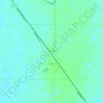
Nom : Carte topographique Sabin, altitude, relief.
Lieu : Sabin, Clay County, Minnesota, United States (46.77563 -96.66266 46.79006 -96.64677)
Altitude moyenne : 282 m
Altitude minimum : 278 m
Altitude maximum : 285 m
Sabin is mostly south under U.S. Route 52 and the shortline railway owned by Otter Tail Valley Railroad Company that runs parallel to Route 52. According to the United States Census Bureau, the city of Sabin has an area of 0.35 square miles (0.91 km2), all land. The elevation is approximately 929 feet.
Autres cartes topographiques
Cliquez sur une carte pour visualiser sa topographie, son altitude et son relief.
Dilworth
United States > Minnesota > Clay County
Dilworth, Clay County, Minnesota, 56529, United States
Altitude moyenne : 278 m
Comstock
United States > Minnesota > Clay County
Comstock, Clay County, Minnesota, 56525, United States
Altitude moyenne : 281 m
Hitterdal
United States > Minnesota > Clay County
Hitterdal, Clay County, Minnesota, United States
Altitude moyenne : 379 m
Georgetown
United States > Minnesota > Clay County
Georgetown, Clay County, Minnesota, United States
Altitude moyenne : 269 m
Baker
United States > Minnesota > Clay County
Baker, Clay County, Minnesota, United States
Altitude moyenne : 286 m
Hitterdahl WMA
United States > Minnesota > Clay County
Hitterdahl WMA, 270th Street North, Clay County, Minnesota, 56552, United States
Altitude moyenne : 379 m
Glyndon
United States > Minnesota > Clay County
Glyndon, Clay County, Minnesota, 56547, United States
Altitude moyenne : 282 m
Moorhead
United States > Minnesota > Clay County
Moorhead, Clay County, Minnesota, United States
Altitude moyenne : 277 m
Kragnes
United States > Minnesota > Clay County
Kragnes, Clay County, Minnesota, United States
Altitude moyenne : 273 m
Ulen
United States > Minnesota > Clay County
Ulen, Clay County, Minnesota, 56585, United States
Altitude moyenne : 352 m
Moorhead
United States > Minnesota > Clay County > Moorhead > Moorhead
Moorhead, Clay County, Minnesota, 56563, United States
Altitude moyenne : 277 m
confluence of Red River of the North and Buffalo River
United States > Minnesota > Clay County
confluence of Red River of the North and Buffalo River, Wiser Township, Clay County, Minnesota, United States
Altitude moyenne : 268 m
Barnesville
United States > Minnesota > Clay County
Barnesville, Clay County, Minnesota, 56514, United States
Altitude moyenne : 311 m
Felton
United States > Minnesota > Clay County
Felton, Clay County, Minnesota, United States
Altitude moyenne : 279 m
Hawley
United States > Minnesota > Clay County
Hawley, Clay County, Minnesota, United States
Altitude moyenne : 356 m