
Carte topographique Gschwender Horn
Carte interactive
Cliquez sur la carte pour afficher l’altitude.
À propos de cette carte
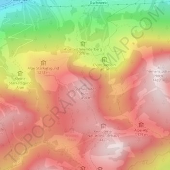
Nom : Carte topographique Gschwender Horn, altitude, relief.
Altitude moyenne : 1 200 m
Altitude minimum : 724 m
Altitude maximum : 1 484 m
Autres cartes topographiques
Cliquez sur une carte pour visualiser sa topographie, son altitude et son relief.
Knottenried
Deutschland > Bayern > Landkreis Oberallgäu > Immenstadt im Allgäu
Knottenried, Immenstadt im Allgäu, Landkreis Oberallgäu, Bayern, 87509, Deutschland
Altitude moyenne : 948 m