
Carte topographique Hadsel
Carte interactive
Cliquez sur la carte pour afficher l’altitude.
À propos de cette carte
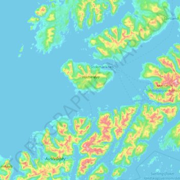
Nom : Carte topographique Hadsel, altitude, relief.
Lieu : Hadsel, Nordland, Norway (68.31908 14.13608 68.68797 15.44285)
Altitude moyenne : 101 m
Altitude minimum : -2 m
Altitude maximum : 1 204 m
Autres cartes topographiques
Cliquez sur une carte pour visualiser sa topographie, son altitude et son relief.
Bodø - Bådåddjo
Bodø - Bådåddjo, Bodø, Nordland, 8005, Norway
Altitude moyenne : 74 m
Haukland Beach
Haukland Beach, Sjøbakken, Vestvågøy, Nordland, Norway
Altitude moyenne : 103 m
Ballangen - Bálák
Ballangen - Bálák, Narvik, Nordland, Norway
Altitude moyenne : 91 m
Sulitjelma - Sulisjielmmá
Sulitjelma - Sulisjielmmá, Fauske, Nordland, Norway
Altitude moyenne : 379 m