
Carte topographique Holycross
Carte interactive
Cliquez sur la carte pour afficher l’altitude.
À propos de cette carte
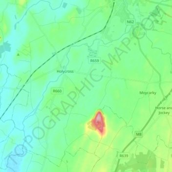
Nom : Carte topographique Holycross, altitude, relief.
Altitude moyenne : 99 m
Altitude minimum : 67 m
Altitude maximum : 217 m
Autres cartes topographiques
Cliquez sur une carte pour visualiser sa topographie, son altitude et son relief.
Mother Mountain
Mother Mountain, The Municipal District of Nenagh, County Tipperary, Munster, Ireland
Altitude moyenne : 368 m
The Municipal District of Nenagh
The Municipal District of Nenagh, County Tipperary, Munster, Ireland
Altitude moyenne : 116 m
Tinderry
Tinderry, Timoney, The Municipal District of Thurles, County Tipperary, Munster, Ireland
Altitude moyenne : 123 m
Glenreagh
Glenreagh, Killea, The Municipal District of Thurles, County Tipperary, Munster, Ireland
Altitude moyenne : 262 m