
Carte topographique Sweetwater County
Carte interactive
Cliquez sur la carte pour afficher l’altitude.
À propos de cette carte
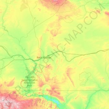
Nom : Carte topographique Sweetwater County, altitude, relief.
Lieu : Sweetwater County, Wyoming, VS (40.99712 -110.05393 42.27055 -107.49941)
Altitude moyenne : 2 142 m
Altitude minimum : 1 633 m
Altitude maximum : 3 855 m
Autres cartes topographiques
Cliquez sur une carte pour visualiser sa topographie, son altitude et son relief.
Yellowstone National Park
Yellowstone National Park, Mary Mountain-Nez Perce, Teton County, Wyoming, VS
Altitude moyenne : 2 450 m
Rock Springs
VS > Wyoming > Rock Springs
Rock Springs, Sweetwater County, Wyoming, 82901, VS
Altitude moyenne : 2 011 m
Grand Teton National Park
Grand Teton National Park, Teton Park Road, Teton County, Wyoming, 83013, VS
Altitude moyenne : 2 409 m