
Carte topographique An Phuoc
Carte interactive
Cliquez sur la carte pour afficher l’altitude.
À propos de cette carte
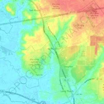
Nom : Carte topographique An Phuoc, altitude, relief.
Lieu : An Phuoc, Long Thành District, Đồng Nai Province, Vietnam (10.77454 106.89350 10.87145 106.98944)
Altitude moyenne : 22 m
Altitude minimum : -2 m
Altitude maximum : 59 m
Autres cartes topographiques
Cliquez sur une carte pour visualiser sa topographie, son altitude et son relief.
Long Thành District
Vietnam > Dong Nai province > Long Thành District
Long Thành District, Dong Nai province, 8464, Vietnam
Altitude moyenne : 41 m