

Cartes topographiques Papua
Cliquez sur une carte pour visualiser sa topographie, son altitude et son relief.

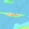
Pulau Biak
Biak covers an area of 2,455 km2 (948 sq mi) The island is 72 km (45 mi) long and 37 km (23 mi) wide at its widest point. The highest point is approximately 740 meters elevation, located in the northwest of the island.
Altitude moyenne : 49 m









À propos de ce lieu
Jayapura • Biak Kota • Yapen Islands Regency • Waropen Regency • Supiori • Jayapura • Sarmi • Mamberamo Raya • Enggros • Deiyai • Tolikara • Timika