

Cartes topographiques Rapur
Cliquez sur une carte pour visualiser sa topographie, son altitude et son relief.
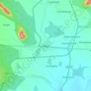
Rapur
India > Andhra Pradesh > Rapur
Rapur is located at 14.2000°N 79.5167°E. It has an average elevation of 90 meters (298 feet). Rapur comes under Nellore district and has a border with Kadapa district. Rapur town is surrounded by very big hills named veligonda which makes it a sightseeing place especially in winter and rainy seasons.…
Altitude moyenne : 91 m