Géolocaliser

Cartes topographiques Pixham

Cliquez sur une carte pour visualiser sa topographie, son altitude et son relief.
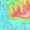
Box Hill

United Kingdom > England > Surrey > Mole Valley > Pixham

The 15.8 km (9.8 mi) Box Hill Olympic circuit is generally cycled in an anticlockwise direction and begins to the south of the village of Mickleham with an ascent of the hill via the Zig Zag Road. From the National Trust Visitor Centre, the route turns eastwards, running along the escarpment and through the…

Altitude moyenne : 105 m

Équipez-vous pour votre prochaine aventure :

🔋Piles rechargeables - Énergie durable pour vos lampes et boussoles numériques
🧰Outils multifonctions - Polyvalence et compacité
🍼Bouteille d'eau isotherme 1L - Maintient l'eau fraîche ou le thé chaud pendant des heures
🧼Savon de camping biodégradable - Respectez l'environnement lors de vos expéditions
🔥Réchauds de camping - Réchauds portables pour cuisine outdoor

En tant que Partenaire Amazon, ce site perçoit une commission sur les achats éligibles sans surcoût pour vous.