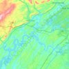
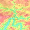
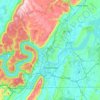
Cliquez sur une carte pour visualiser sa topographie, son altitude et son relief.
États-Unis d'Amérique > Tennessee > Hamblen County
Altitude moyenne : 380 m
États-Unis d'Amérique > Tennessee > Franklin County
Altitude moyenne : 290 m
États-Unis d'Amérique > Tennessee > Madison County
Altitude moyenne : 143 m
États-Unis d'Amérique > Tennessee > Petros
Altitude moyenne : 590 m
États-Unis d'Amérique > Tennessee > Davidson County
Altitude moyenne : 184 m
États-Unis d'Amérique > Tennessee > Stewart County
Altitude moyenne : 134 m
États-Unis d'Amérique > Tennessee > Knox County
Altitude moyenne : 307 m
États-Unis d'Amérique > Tennessee > Weakley County
Altitude moyenne : 126 m
États-Unis d'Amérique > Tennessee
Altitude moyenne : 313 m
États-Unis d'Amérique > Tennessee > Hamilton County
Altitude moyenne : 323 m
États-Unis d'Amérique > Tennessee > Cocke County
Altitude moyenne : 824 m
États-Unis d'Amérique > Tennessee > Montgomery County
Altitude moyenne : 155 m
Altitude moyenne : 331 m
États-Unis d'Amérique > Tennessee > Sevier County
Altitude moyenne : 312 m
Altitude moyenne : 149 m
États-Unis d'Amérique > Tennessee > Morgan County
Altitude moyenne : 579 m
Altitude moyenne : 564 m
États-Unis d'Amérique > Tennessee > Rutherford County
Altitude moyenne : 188 m
États-Unis d'Amérique > Tennessee > Washington County
Altitude moyenne : 513 m
Altitude moyenne : 235 m
États-Unis d'Amérique > Tennessee > Shelby County > Memphis
Altitude moyenne : 93 m
États-Unis d'Amérique > Tennessee > Shelby County
Altitude moyenne : 81 m
États-Unis d'Amérique > Tennessee > Marion County
Altitude moyenne : 429 m
États-Unis d'Amérique > Tennessee > Grundy County
Altitude moyenne : 565 m
États-Unis d'Amérique > Tennessee > Greene County
Altitude moyenne : 379 m
États-Unis d'Amérique > Tennessee > Cumberland County
Altitude moyenne : 543 m
Altitude moyenne : 378 m
Altitude moyenne : 803 m
Altitude moyenne : 366 m
Altitude moyenne : 388 m
Altitude moyenne : 763 m
En tant que Partenaire Amazon, ce site perçoit une commission sur les achats éligibles sans surcoût pour vous.