
Carte topographique Fenelon Falls
Carte interactive
Cliquez sur la carte pour afficher l’altitude.
À propos de cette carte
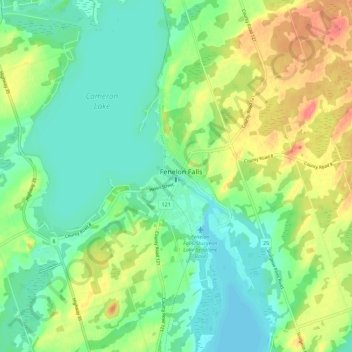
Nom : Carte topographique Fenelon Falls, altitude, relief.
Lieu : Fenelon Falls, Kawartha Lakes, Ontario, K0M 1N0, Canada (44.49593 -78.77790 44.57593 -78.69790)
Altitude moyenne : 268 m
Altitude minimum : 245 m
Altitude maximum : 311 m