
Faire un don
Équipez-vous pour votre prochaine aventure :
En tant que Partenaire Amazon, ce site perçoit une commission sur les achats éligibles sans surcoût pour vous.
Carte topographique Pass Christian
Cliquez sur la carte pour afficher l’altitude.
Faire un don
Équipez-vous pour votre prochaine aventure :
En tant que Partenaire Amazon, ce site perçoit une commission sur les achats éligibles sans surcoût pour vous.
Pass Christian
On August 29, 2005, Pass Christian was almost completely destroyed by Hurricane Katrina. Of the approximately 8,000 homes in Pass Christian, all but 500 were damaged or destroyed. In spite of the fact that the beachfront Scenic Drive follows the crest of a small bluff, affording it some elevation, most of the historic mansions along the road were severely damaged, and many were completely destroyed, including the superbly restored Greek Revival mansion "Union Quarters" described in the National Register of Historic Places as having been built in 1855. A cast iron fence fronted the property enclosing a Magnolia Historical Marker which was dedicated in 1960. It read, "Union officers were temporarily quartered here during the invasion of Pass Christian."
Faire un don
Équipez-vous pour votre prochaine aventure :
En tant que Partenaire Amazon, ce site perçoit une commission sur les achats éligibles sans surcoût pour vous.
À propos de cette carte
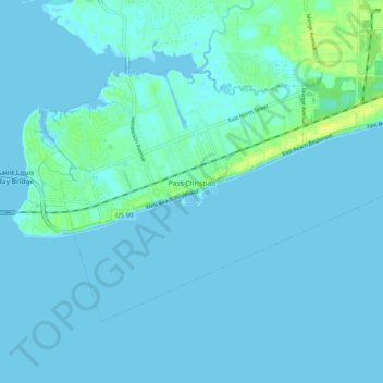
Nom : Carte topographique Pass Christian, altitude, relief.
Altitude moyenne : 2 m
Altitude minimum : -3 m
Altitude maximum : 14 m
Faire un don
Équipez-vous pour votre prochaine aventure :
En tant que Partenaire Amazon, ce site perçoit une commission sur les achats éligibles sans surcoût pour vous.