
Carte topographique Thayne
Carte interactive
Cliquez sur la carte pour afficher l’altitude.
Thayne
Thayne is located at 42°55′11″N 111°0′3″W / 42.91972°N 111.00083°W / 42.91972; -111.00083 (42.919754, –111.000714), at 5906 feet in elevation. It sits in the northern portion of Wyoming's grassy Star Valley, close to the Salt River. Thayne is surrounded by green grassland and ranches, with forested mountains at the valley's edge.
À propos de cette carte
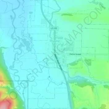
Nom : Carte topographique Thayne, altitude, relief.
Lieu : Thayne, Lincoln County, Wyoming, 83127, United States (42.90253 -111.01238 42.93177 -110.97281)
Altitude moyenne : 1 814 m
Altitude minimum : 1 783 m
Altitude maximum : 1 961 m
Autres cartes topographiques
Cliquez sur une carte pour visualiser sa topographie, son altitude et son relief.