
Carte topographique Yuyin
Carte interactive
Cliquez sur la carte pour afficher l’altitude.
À propos de cette carte
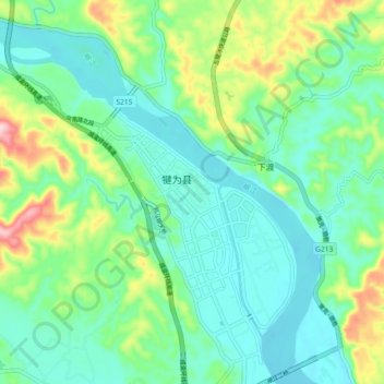
Nom : Carte topographique Yuyin, altitude, relief.
Lieu : Yuyin, Qianwei County, Leshan, Sichuan, China (29.16851 103.90732 29.24851 103.98732)
Altitude moyenne : 370 m
Altitude minimum : 311 m
Altitude maximum : 536 m
Autres cartes topographiques
Cliquez sur une carte pour visualiser sa topographie, son altitude et son relief.
土坪村
China > Sichuan > Qianwei County > Xinmin
土坪村, Xinmin, Qianwei County, Leshan, Sichuan, China
Altitude moyenne : 370 m