
Carte topographique People's Park in the Sky
Carte interactive
Cliquez sur la carte pour afficher l’altitude.
À propos de cette carte
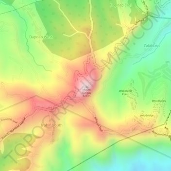
Nom : Carte topographique People's Park in the Sky, altitude, relief.
Altitude moyenne : 503 m
Altitude minimum : 270 m
Altitude maximum : 728 m
Autres cartes topographiques
Cliquez sur une carte pour visualiser sa topographie, son altitude et son relief.
Tagaytay Highlands
Philippines > Cavite > Tagaytay > Iruhin South
Tagaytay Highlands, Woodland Point, Iruhin South, Tagaytay, Cavite, Calabarzon, 4120, Philippines
Altitude moyenne : 428 m