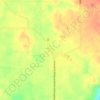
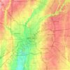
Carte topographique Greene
Cliquez sur la carte pour afficher l’altitude.
À propos de cette carte

Nom : Carte topographique Greene, altitude, relief.
Lieu : Greene, Indiana, United States (38.32271 -87.69585 39.72271 -86.29585)
Altitude moyenne : 186 m
Altitude minimum : 115 m
Altitude maximum : 315 m
Autres cartes topographiques
Cliquez sur une carte pour visualiser sa topographie, son altitude et son relief.





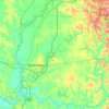
Daviess County
The terrain of Daviess County is hilly, with its area completely devoted to agriculture or urban development. Its highest elevation (740'/266 meters ASL) is a rise one mile (1.6 km) NNE of Farlen. The county is drained by the White River flowing to the southwest, whose two main forks (East White and West…
Altitude moyenne : 154 m


Ridgeville
United States > Indiana > Randolph County
A post office called Ridgeville has been in operation since 1851. The town was named for its lofty elevation. Joab Ward, an old Settler to Ridgeville since 1819, originally laid out the village of Ridgeville, Randolph County, Indiana in 1854.
Altitude moyenne : 306 m
Bremen
United States > Indiana > Marshall County
Bremen is located in northeastern Marshall County at 41°26′50″N 86°08′58″W / 41.447109°N 86.149342°W / 41.447109; -86.149342. It is at an elevation of 854 feet (260 m).
Altitude moyenne : 252 m




Fort Harrison State Park
United States > Indiana > Marion County > Indianapolis
Altitude moyenne : 251 m













Parker City
United States > Indiana > Randolph County
According to the 2010 census, Parker City has a total area of 0.57 square miles (1.48 km2), all land. It is located at an elevation of 1025 feet.
Altitude moyenne : 312 m