
Carte topographique Than Tho Lake
Carte interactive
Cliquez sur la carte pour afficher l’altitude.
À propos de cette carte
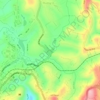
Nom : Carte topographique Than Tho Lake, altitude, relief.
Altitude moyenne : 1 521 m
Altitude minimum : 1 437 m
Altitude maximum : 1 621 m
Autres cartes topographiques
Cliquez sur une carte pour visualiser sa topographie, son altitude et son relief.
Dalat
Vietnam > Lâm Đồng Province > Dalat
Dalat, Đà Lạt District, Lâm Đồng Province, 6700, Vietnam
Altitude moyenne : 1 360 m