
Carte topographique Col du Lautaret
Carte interactive
Cliquez sur la carte pour afficher l’altitude.
À propos de cette carte
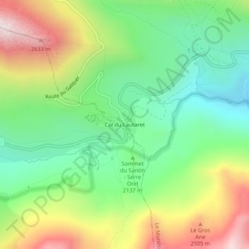
Nom : Carte topographique Col du Lautaret, altitude, relief.
Altitude moyenne : 2 261 m
Altitude minimum : 1 804 m
Altitude maximum : 3 117 m
From the west, the climb starts at Les Clapier, near Le Bourg-d'Oisans, from where the climb is 34.2 km (21.3 mi) long, gaining 1,312 m (4,304 ft) in altitude, at an average gradient of 3.8%, with the steepest section being at 7.5% in the first kilometre.