
Carte topographique Swindon
Carte interactive
Cliquez sur la carte pour afficher l’altitude.
À propos de cette carte
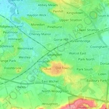
Nom : Carte topographique Swindon, altitude, relief.
Lieu : Swindon, England, SN1 1LF, United Kingdom (51.52137 -1.82569 51.60137 -1.74569)
Altitude moyenne : 108 m
Altitude minimum : 83 m
Altitude maximum : 180 m
Swindon has an oceanic climate (Cfb in the Köppen climate classification), like the vast majority of the British Isles, with cool winters and warm summers. The nearest official weather station is RAF Lyneham, about 10 miles (16 km) west southwest of Swindon town centre. The weather station's elevation is 145 metres (476 ft) in a rural setting, compared to the typical 100 metres (330 ft) encountered around Swindon town centre, so is likely marginally cooler throughout the year.