Carte topographique Lethbridge
Cliquez sur la carte pour afficher l’altitude.
Lethbridge
Its high elevation of 929 m (3,047.9 ft) and close proximity to the Rocky Mountains provides Lethbridge with cooler summers than other locations in the Canadian Prairies. These factors protect the city from strong northwest and southwest winds and contribute to frequent chinook winds during the winter. Lethbridge winters have the highest temperatures in the prairies, reducing the severity and duration of winter cold periods and resulting in fewer days with snow cover. The average daytime temperature peaks by the end of July/beginning of August, when it reaches 26.4 °C (79.5 °F). The city's temperature reaches a maximum high of 35 °C (95 °F) or greater on average once or twice a year.
À propos de cette carte
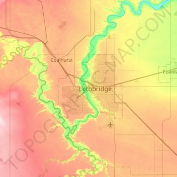
Nom : Carte topographique Lethbridge, altitude, relief.
Lieu : Lethbridge, City of Lethbridge, Alberta, T1J 4L3, Canada (49.53429 -113.01156 49.85429 -112.69156)
Altitude moyenne : 918 m
Altitude minimum : 782 m
Altitude maximum : 1 056 m
Autres cartes topographiques
Cliquez sur une carte pour visualiser sa topographie, son altitude et son relief.