
Carte topographique Admiralty Islands
Carte interactive
Cliquez sur la carte pour afficher l’altitude.
À propos de cette carte
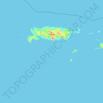
Nom : Carte topographique Admiralty Islands, altitude, relief.
Lieu : Admiralty Islands, Manus, Islands Region, Papua New Guinea (-2.90377 146.38894 -1.90289 148.20718)
Altitude moyenne : 5 m
Altitude minimum : -3 m
Altitude maximum : 675 m
Manus reaches an elevation of 700 m (2,300 ft) and is volcanic in origin and probably broke through the ocean's surface in the late Miocene, 8–10 million years ago. The substrate of the island is either directly volcanic or from uplifted coral limestone.
Autres cartes topographiques
Cliquez sur une carte pour visualiser sa topographie, son altitude et son relief.
Ninigo Islands
Ninigo Islands, Manus, Islands Region, Papua New Guinea
Altitude moyenne : 0 m