
Carte topographique Holambra
Carte interactive
Cliquez sur la carte pour afficher l’altitude.
Holambra
Holambra (from the words Holland-America-Brazil) is a municipality in the state of São Paulo in Brazil. It is part of the Metropolitan Region of Campinas. Holambra is the largest producer of flowers and ornamental plants in Latin America, also hosting the largest spring event in the continent, the Expoflora. The population is 15,272 (2020 est.) in an area of 65.58 km2. The elevation is 600m on average.
À propos de cette carte
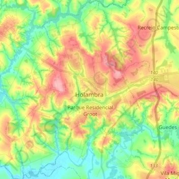
Nom : Carte topographique Holambra, altitude, relief.
Altitude moyenne : 594 m
Altitude minimum : 542 m
Altitude maximum : 663 m