
Carte topographique Cao Lãnh
Carte interactive
Cliquez sur la carte pour afficher l’altitude.
À propos de cette carte
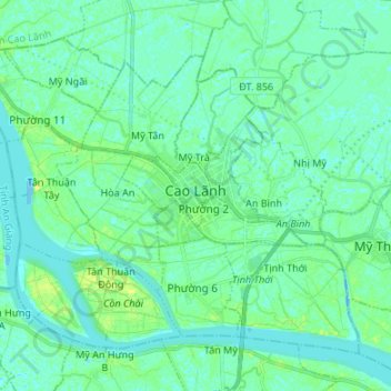
Nom : Carte topographique Cao Lãnh, altitude, relief.
Lieu : Cao Lãnh, Đồng Tháp Province, Vietnam (10.40689 105.55777 10.51327 105.69188)
Altitude moyenne : 5 m
Altitude minimum : -5 m
Altitude maximum : 16 m
Autres cartes topographiques
Cliquez sur une carte pour visualiser sa topographie, son altitude et son relief.
Binh Thanh
Vietnam > Đồng Tháp Province > Lap Vo District
Binh Thanh, Lap Vo District, Đồng Tháp Province, Vietnam
Altitude moyenne : 4 m
Hong Ngu City
Hong Ngu City, Đồng Tháp Province, Vietnam
Altitude moyenne : 3 m