
Carte topographique Kwenxura
Carte interactive
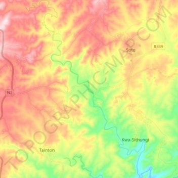
Cliquez sur la carte pour afficher l’altitude.
À propos de cette carte
Nom : Carte topographique Kwenxura, altitude, relief.
Altitude moyenne : 236 m
Altitude minimum : 4 m
Altitude maximum : 465 m
Autres cartes topographiques
Cliquez sur une carte pour visualiser sa topographie, son altitude et son relief.
Great Kei Ward 1
RSA > Eastern Cape > Great Kei Local Municipality
Great Kei Ward 1, Great Kei Local Municipality, Amathole District Municipality, Eastern Cape, RSA
Altitude moyenne : 118 m
Great Kei Ward 6
RSA > Eastern Cape > Great Kei Local Municipality
Great Kei Ward 6, Great Kei Local Municipality, Amathole District Municipality, Eastern Cape, RSA
Altitude moyenne : 132 m