Carte topographique Manipal
Cliquez sur la carte pour afficher l’altitude.
Manipal
Manipal is a suburb and university town within Udupi, in coastal Karnataka, India. Manipal is located five kilometres away from the centre of Udupi City, in Udupi District, Karnataka (state) in south western India. It is administered by the Udupi City Municipality. The suburb is located in coastal Karnataka, 62 km north of Mangalore and 8 km east of the Arabian Sea. From its location on a plateau, at an altitude of about 75 m above sea level, it commands a panoramic view of the Arabian Sea to the west and the Western Ghats to the east.
À propos de cette carte
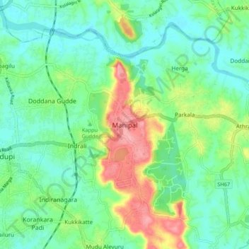
Nom : Carte topographique Manipal, altitude, relief.
Lieu : Manipal, Udupi taluku, Udupi, Karnataka, 576104, India (13.31197 74.74703 13.39197 74.82703)
Altitude moyenne : 32 m
Altitude minimum : -1 m
Altitude maximum : 103 m
Autres cartes topographiques
Cliquez sur une carte pour visualiser sa topographie, son altitude et son relief.