

Carte topographique Yugar
Cliquez sur la carte pour afficher l’altitude.
À propos de cette carte

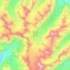
Nom : Carte topographique Yugar, altitude, relief.
Lieu : Yugar, Zanskar tehsil, Kargil district, Ladakh, India (33.24648 77.16276 33.28648 77.20276)
Altitude moyenne : 4 223 m
Altitude minimum : 3 798 m
Altitude maximum : 4 998 m
Autres cartes topographiques
Cliquez sur une carte pour visualiser sa topographie, son altitude et son relief.
Drang Drung Glacier
India > Ladakh > Zanskar tehsil
The Drang-Drung Glacier is likely to be the largest glacier in Ladakh after the Siachen Glacier in the Karakoram Range, with a maximum length of 23 km (14 mi) at an average elevation of 4,780 m (15,680 ft; 2.97 mi). The glacier lies in the northeastern Himalayan Range known as the Zanskar Range, 142 km (88 mi)…
Altitude moyenne : 5 098 m