
Carte topographique Meander River
Carte interactive
Cliquez sur la carte pour afficher l’altitude.
À propos de cette carte
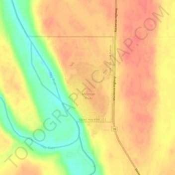
Nom : Carte topographique Meander River, altitude, relief.
Lieu : Meander River, Mackenzie County, Alberta, Canada (59.03497 -117.72398 59.05497 -117.70398)
Altitude moyenne : 325 m
Altitude minimum : 292 m
Altitude maximum : 341 m
The settlement is located on the banks of the Hay River, at an elevation of 328 meters (1,076 ft). The plant hardiness zone of Meander River is 0B, the second lowest possible within Canada, due primarily to its northern latitude.