
Carte topographique Fort Saskatchewan
Carte interactive
Cliquez sur la carte pour afficher l’altitude.
À propos de cette carte
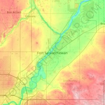
Nom : Carte topographique Fort Saskatchewan, altitude, relief.
Lieu : Fort Saskatchewan, Alberta, T8L 1Y8, Canada (53.55297 -113.37411 53.87297 -113.05411)
Altitude moyenne : 662 m
Altitude minimum : 591 m
Altitude maximum : 759 m
Autres cartes topographiques
Cliquez sur une carte pour visualiser sa topographie, son altitude et son relief.
William Casey Park
Canada > Alberta > Fort Saskatchewan
William Casey Park, Fort Saskatchewan, Alberta, Canada
Altitude moyenne : 624 m