
Carte topographique Aburi
Carte interactive
Cliquez sur la carte pour afficher l’altitude.
Aburi
Due to the altitude of Aburi, the climate is a lot cooler than neighbouring Accra. The road which climbs the hillside to Aburi is a toll road, with the current toll being 0.50 Ghc for a car, 1.00 Ghc for a 4x4.
À propos de cette carte
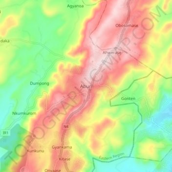
Nom : Carte topographique Aburi, altitude, relief.
Lieu : Aburi, Akuapim South District, Eastern Region, Ghana (5.80748 -0.21527 5.88748 -0.13527)
Altitude moyenne : 277 m
Altitude minimum : 88 m
Altitude maximum : 478 m