
Carte topographique Can Lộc District
Carte interactive
Cliquez sur la carte pour afficher l’altitude.
À propos de cette carte
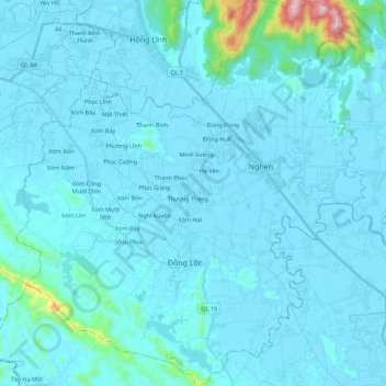
Nom : Carte topographique Can Lộc District, altitude, relief.
Lieu : Can Lộc District, Ha Tinh Province, Vietnam (18.33768 105.62990 18.54944 105.83251)
Altitude moyenne : 39 m
Altitude minimum : -2 m
Altitude maximum : 662 m
Autres cartes topographiques
Cliquez sur une carte pour visualiser sa topographie, son altitude et son relief.
Hương Khê District
Hương Khê District, Hà Tĩnh Province, 46003, Vietnam
Altitude moyenne : 262 m
Vĩnh Phúc
Vietnam > Ha Tinh Province > Vĩnh Phúc
Vĩnh Phúc, Can Lộc District, Ha Tinh Province, Vietnam
Altitude moyenne : 13 m
Hương Sơn District
Hương Sơn District, Ha Tinh Province, Vietnam
Altitude moyenne : 513 m