
Carte topographique Parachinar
Carte interactive
Cliquez sur la carte pour afficher l’altitude.
À propos de cette carte
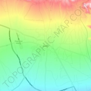
Nom : Carte topographique Parachinar, altitude, relief.
Altitude moyenne : 1 740 m
Altitude minimum : 1 535 m
Altitude maximum : 2 130 m
Autres cartes topographiques
Cliquez sur une carte pour visualiser sa topographie, son altitude et son relief.
Shalozan
Pakistan > Khyber Pakhtunkhwa > Kurram District
Shalozan, Upper Kurram Tehsil, Kurram District, Kohat Division, Khyber Pakhtunkhwa, Pakistan
Altitude moyenne : 1 945 m