Géolocaliser

Carte topographique Una

Cliquez sur la carte pour afficher l’altitude.

Una

Una is located on the bank of the Machchundri river. It has an average elevation of 14 metres (46 feet). Kodinar is located to the west, and Diu is to the south. Una has the highest number of villages of all the Talukas in Gujarat state.

Wikipedia (CC-BY-SA 3.0)

À propos de cette carte

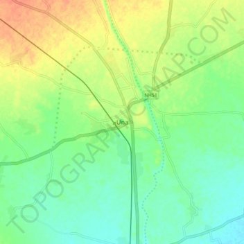
Nom : Carte topographique Una, altitude, relief.

Lieu : Una, Una Taluka, Gir Somnath, Gujarat, 362560, India (20.77989 70.99916 20.85989 71.07916)

Altitude moyenne : 25 m

Altitude minimum : 8 m

Altitude maximum : 48 m

Équipez-vous pour votre prochaine aventure :

🧤Chauffe-mains rechargeables - Chaleur instantanée dans vos poches ou gants
🔦Lampes frontales - Éclairage mains libres pour randonnée et camping
🔊Haut-parleur Bluetooth étanche - Musique pour le camp de base résistant aux intempéries
🌧️Vestes imperméables - Protection contre pluie et vent
🕶️Lunettes polarisées outdoor - Lunettes pour réduire l'éblouissement en nature

En tant que Partenaire Amazon, ce site perçoit une commission sur les achats éligibles sans surcoût pour vous.