Géolocaliser

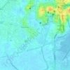
Carte topographique Veloor

Cliquez sur la carte pour afficher l’altitude.

À propos de cette carte

Nom : Carte topographique Veloor, altitude, relief.

Lieu : Veloor, Kottayam, Kerala, 686020, India (9.56217 76.47880 9.60217 76.51880)

Altitude moyenne : 5 m

Altitude minimum : -4 m

Altitude maximum : 33 m

Autres cartes topographiques

Cliquez sur une carte pour visualiser sa topographie, son altitude et son relief.
Alapuzha

India > Kerala > Kottayam > Kottayam

Altitude moyenne : 10 m

Karapuzha

India > Kerala > Kottayam > Kottayam

Altitude moyenne : 7 m

Sankranthi

India > Kerala > Kottayam > Kottayam

Altitude moyenne : 15 m

Meenadom

India > Kerala > Kottayam > Pariyaram

Altitude moyenne : 36 m

Manimala River

India > Kerala > Kottayam > Eravinalloor

Altitude moyenne : 12 m

Kanjikuzhy

India > Kerala > Kottayam > Manganam

Altitude moyenne : 14 m

Meenachil

India > Kerala > Kottayam > Pulikuttisseri

Altitude moyenne : 7 m

child

India > Kerala > Kottayam > Thiruvanchoor

Altitude moyenne : 13 m

Alapuzha

India > Kerala > Kottayam > Kottayam

Altitude moyenne : 10 m

Alapuzha

India > Kerala > Kottayam > Kottayam

Altitude moyenne : 10 m

Équipez-vous pour votre prochaine aventure :

🎒Sacs à dos journée - Sacs compacts pour randonnées à la journée
👣Semelles de remplacement confort - Améliorez le soutien de vos bottes pour les longues marches
🔪Outil multifonction de poche - Indispensable pour les petites réparations sur le terrain
🍲Repas lyophilisés pour camping - Nourriture légère et nutritive pour les longues randonnées
🔦Lanterne de camping LED - Éclairage d'ambiance pour l'intérieur de la tente

En tant que Partenaire Amazon, ce site perçoit une commission sur les achats éligibles sans surcoût pour vous.