
Carte topographique Lake Waco
Carte interactive
Cliquez sur la carte pour afficher l’altitude.
Lake Waco
The average elevation of Lake Waco is held around 460 feet above sea level, with a typical fluctuation of 2–6 feet. Prior to the construction of the new dam, droughts and floods were common occurrences for the city of Waco. However, the new dam has proven to be the proper solution, as there has not been any serious floods since its installation. However, a 2011 study from the Texas Water Development Board found that Lake Waco loses between 206-334 acre-feet of capacity every year due to sediment deposition.
À propos de cette carte
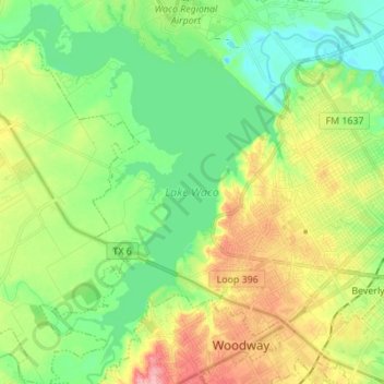
Nom : Carte topographique Lake Waco, altitude, relief.
Lieu : Lake Waco, Waco, McLennan County, Texas, United States (31.49404 -97.29888 31.61117 -97.18973)
Altitude moyenne : 157 m
Altitude minimum : 118 m
Altitude maximum : 223 m
Autres cartes topographiques
Cliquez sur une carte pour visualiser sa topographie, son altitude et son relief.