
Carte topographique Anderson Glacier
Carte interactive
Cliquez sur la carte pour afficher l’altitude.
À propos de cette carte
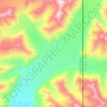
Nom : Carte topographique Anderson Glacier, altitude, relief.
Lieu : Anderson Glacier, Valdez-Cordova, Alaska, USA (61.05083 -141.17872 61.18112 -140.99535)
Altitude moyenne : 1 959 m
Altitude minimum : 1 187 m
Altitude maximum : 3 367 m
Autres cartes topographiques
Cliquez sur une carte pour visualiser sa topographie, son altitude et son relief.
Mendenhaven
USA > Alaska > Mendenhaven
Mendenhaven, Juneau, Alaska, 99801, USA
Altitude moyenne : 126 m
Matanuska Glacier
Matanuska Glacier, Matanuska-Susitna, Alaska, USA
Altitude moyenne : 1 819 m
Shadows Glacier
Shadows Glacier, Matanuska-Susitna, Alaska, USA
Altitude moyenne : 1 464 m
Revillagigedo Island
Revillagigedo Island, Ketchikan Gateway, Alaska, USA
Altitude moyenne : 342 m
Byron Glacier
Byron Glacier, Byron Glacier Trail, Anchorage, Alaska, USA
Altitude moyenne : 749 m
Kanikula Glacier
Kanikula Glacier, Matanuska-Susitna, Alaska, USA
Altitude moyenne : 1 606 m
Mitkof Island
Mitkof Island, Petersburg Borough, Alaska, 99833, USA
Altitude moyenne : 154 m
Kennicott Glacier
Kennicott Glacier, Valdez-Cordova, Alaska, USA
Altitude moyenne : 1 845 m
Chenega Glacier
Chenega Glacier, Unorganized Borough, Alaska, USA
Altitude moyenne : 752 m
Worthington Glacier
Worthington Glacier, Richardson Highway, Ptarmigan, Valdez-Cordova, Alaska, USA
Altitude moyenne : 1 356 m